Makalu Barun National Park Trek
March 23, 2026 | admin
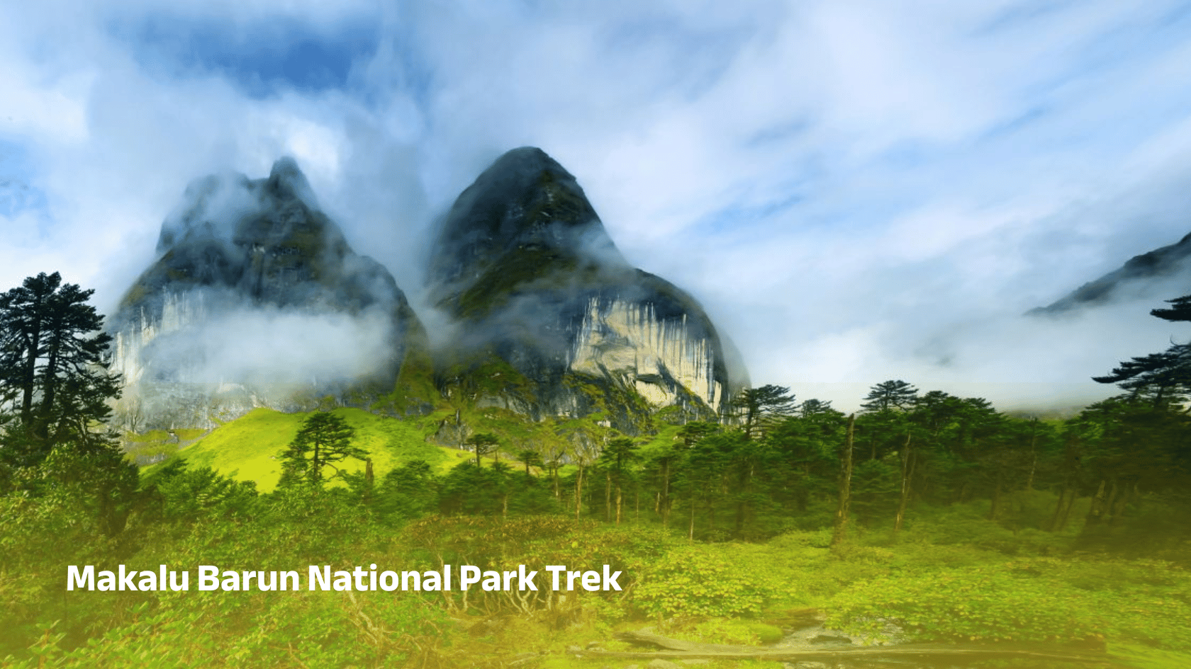
Complete guide to Makalu Barun National Park trek including location, area, height, map, distance from Kathmandu and itinerary.
Makalu Barun National Park is one of Nepal’s most remote and pristine natural treasures. Located in the eastern Himalayas, this park is a paradise for trekkers seeking untouched landscapes, dramatic mountain scenery, and a true wilderness experience.
Unlike popular trekking regions such as Everest or Annapurna, the Makalu Barun National Park trek offers solitude, raw nature, and an authentic Himalayan adventure. It is ideal for experienced trekkers who want to explore beyond the mainstream routes.
This complete guide explains everything about Makalu Barun National Park and its trekking routes, including location, area, height, map, distance from Kathmandu, itinerary, and essential travel information.
Where Is Makalu Barun National Park Located?
Makalu Barun National Park is located in eastern Nepal, covering:
- Sankhuwasabha District
- Solukhumbu District
It lies between the Everest (Sagarmatha) and Kangchenjunga regions, forming part of a large Himalayan conservation area.
The park is named after Mount Makalu (8,485 m) and the Barun Valley.
Area of Makalu Barun National Park
The park covers approximately 1,500 square kilometers.
Buffer zone: around 830 square kilometers.
Landscape Features
- Dense forests
- River valleys
- Glacial terrain
- High mountain peaks
Height and Altitude Range
Altitude ranges from 435 meters to 8,485 meters (Mount Makalu).
Ecosystems Found
- Subtropical forests
- Temperate forests
- Alpine meadows
- Snow-covered mountains
Kathmandu to Makalu Barun National Park
Step 1: Flight to Tumlingtar
Duration: 45 to 60 minutes
Step 2: Drive to Num
Duration: 6 to 8 hours
Step 3: Trek Begins
The trek officially starts from Num.
Total Distance
Approximately 400 to 500 kilometers from Kathmandu.
Map and Trekking Route
The route follows the Arun River valley toward Barun Valley.
Typical Route
- Kathmandu - Tumlingtar - Num - Seduwa - Tashigaon
- Khongma - Dobate - Yangle Kharka - Langmale
- Makalu Base Camp
Key Highlights
- Barun Valley
- Makalu Base Camp
- Arun River
- High mountain passes
Trek Distance
Total trekking distance: 150 to 200 kilometers (round trip).
Daily Trekking
- 10 to 15 kilometers per day
- 5 to 7 hours walking
Makalu Barun Trek Itinerary (16 Days)
- Day 1: Fly to Tumlingtar
- Day 2: Drive to Num
- Day 3: Trek to Seduwa
- Day 4: Trek to Tashigaon
- Day 5: Trek to Khongma
- Day 6: Acclimatization
- Day 7: Trek to Dobate
- Day 8: Trek to Yangle Kharka
- Day 9: Trek to Langmale
- Day 10: Makalu Base Camp
- Day 11: Exploration
- Day 12–15: Return trek
- Day 16: Return to Kathmandu
Difficulty Level
This trek is considered challenging.
Reasons
- Remote trails
- High altitude
- Limited facilities
- Long trekking days
Best Time to Visit
Spring (March to May)
Blooming rhododendrons and stable weather.
Autumn (September to November)
Clear skies and best mountain views.
Weather
Lower Regions
Warm and humid.
Mid-Altitude
Cool and temperate.
High Altitude
Cold and alpine conditions.
Wildlife and Biodiversity
Animals
- Snow leopard
- Red panda
- Himalayan black bear
- Musk deer
Birds
Over 400 species.
Plants
Thousands of species including medicinal herbs.

Permits Required
Accommodation and Facilities
- Teahouses in villages
- Camping in remote areas
Facilities are basic and limited.
Why Choose Makalu Barun Trek
- Less crowded
- Unspoiled nature
- High mountain adventure
- Unique cultural experience
Preparation Tips
- Train physically
- Carry proper gear
- Hire experienced guides
- Prepare for remote conditions
Conclusion
Makalu Barun National Park offers one of the most adventurous and remote trekking experiences in Nepal. With dramatic landscapes, diverse ecosystems, and stunning views of Mount Makalu, it provides a truly unforgettable journey.
For those seeking a challenging and less crowded Himalayan adventure, the Makalu Barun National Park trek is one of the best choices in Nepal.
Frequently Asked Questions
Where is Makalu Barun National Park located?
It is located in eastern Nepal between Everest and Kangchenjunga regions.
What is the area of the park?
About 1,500 square kilometers.
How high is Makalu Barun National Park?
Altitude ranges from 435 meters to 8,485 meters.
How far is it from Kathmandu?
Approximately 400 to 500 kilometers.
How do I reach the park?
Fly to Tumlingtar, drive to Num, then trek.
How long is the trek?
Usually 14 to 18 days.
What is the trek distance?
Around 150 to 200 kilometers.
Is the trek difficult?
Yes, it is challenging.
What is the best time to visit?
Spring and autumn.
What permits are required?
Park permit and TIMS card.
What wildlife can be seen?
Snow leopards, red pandas, and bears.
Is the trek crowded?
No, it is less crowded.
Can beginners do this trek?
It is best for experienced trekkers.
What is Makalu Base Camp?
It is the base camp of Mount Makalu.
Why is Makalu Barun famous?
For biodiversity and untouched landscapes.